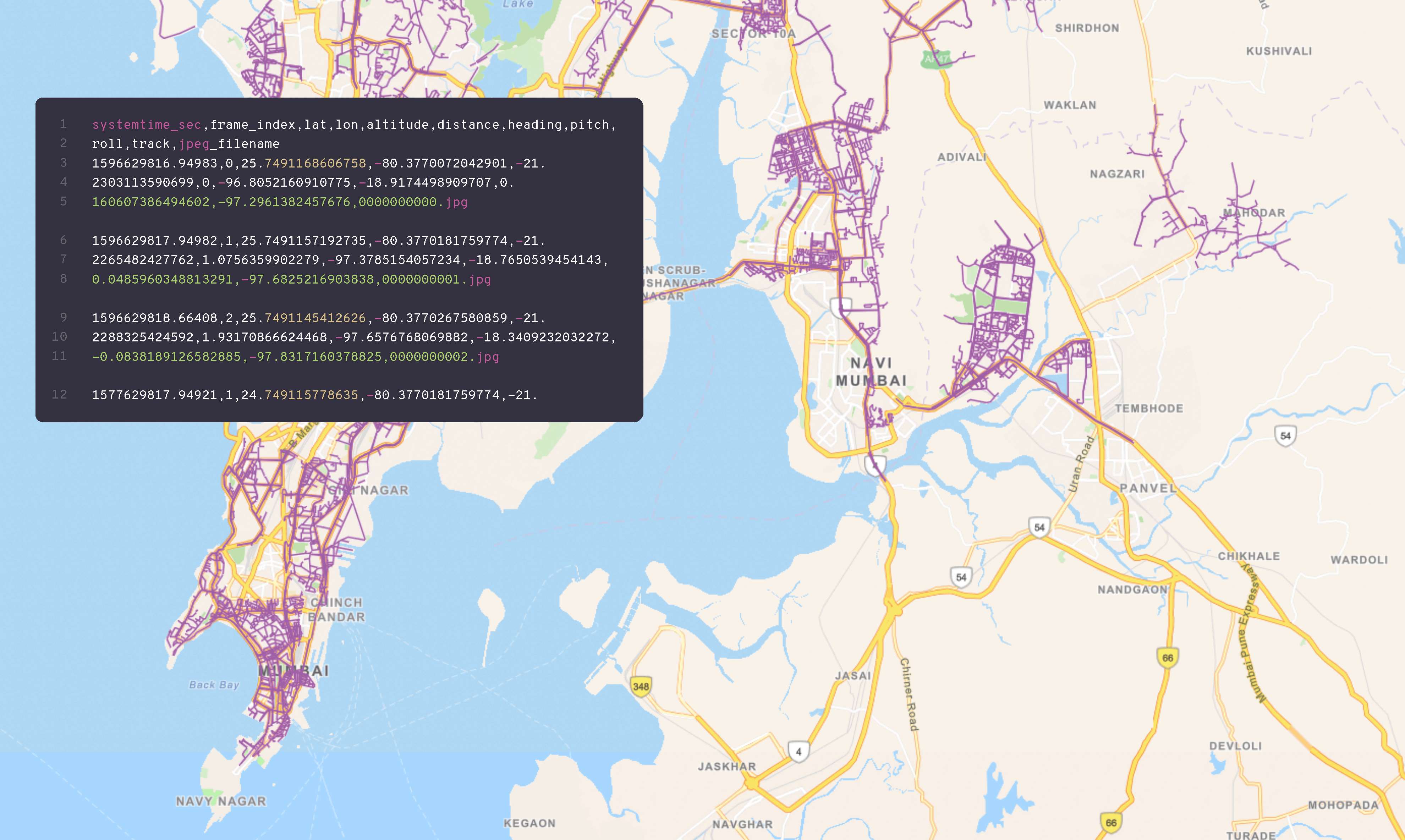
Trajectory data
Capturing the world with spherical, lidar, and trajectory data.
Description
Trajectory data is a key component of mobile mapping technology. It refers to the series of location coordinates that are recorded by sensors on a mobile mapping system as it travels along a route. These coordinates can be used to generate a highly accurate and detailed digital map of the environment, including the position of road networks, buildings, and other infrastructure.
Mobile mapping systems typically use a combination of GPS, inertial measurement units (IMUs), and other sensors to collect trajectory data. The data is then processed using specialized software to create a detailed 3D model of the environment, which can be used for a range of applications, such as urban planning, infrastructure management, and emergency response.
Overall, trajectory data plays a vital role in mobile mapping and has numerous applications in urban planning, transportation, and related fields.

Technical information
-
The number of satellites in the constellation directly impacts the accuracy and availability of the GNSS system. More satellites can provide better coverage and accuracy, especially in areas where line of sight to the satellites is obstructed. Currently, both the Global Positioning System (GPS) and the Russian GLONASS system have 24 satellites in orbit, while the European Union's Galileo system and China's BeiDou system have 30 and 35 satellites respectively.
-
GNSS systems are used for a wide range of applications, from navigation to surveying and precision agriculture. The accuracy of the system is measured in terms of its positioning error, which is the difference between the true position and the position calculated by the GNSS system. Different GNSS systems have different levels of accuracy, ranging from a few meters to a few centimeters. The accuracy can be affected by various factors, such as the number of satellites in view, the quality of the signal, and the type of receiver used.
-
GNSS satellites transmit signals at different frequencies, typically in the L-band range of 1 to 2 GHz. The signal strength is an important specification as it affects the ability of the receiver to lock onto the signal and maintain a stable connection. The signal strength can be affected by atmospheric conditions and interference from other sources, such as buildings or other electronic devices. To overcome these challenges, GNSS systems use various techniques such as signal filtering and error correction to improve the signal quality and maintain a stable connection.
-
This refers to the range of acceleration and angular velocity that the IMU can accurately measure. The sensing range is typically specified in terms of maximum and minimum acceleration and angular velocity.
-
This refers to the degree of error in the measurement of the specific force and angular rate. IMUs can have errors due to a variety of factors, including noise, bias, drift, and temperature effects. The accuracy of an IMU is typically specified in terms of the Root Mean Square (RMS) of the error.
-
This refers to the rate at which the IMU samples the acceleration and angular velocity. The sampling rate is typically specified in Hertz (Hz), and it determines the frequency at which the IMU updates its readings. Higher sampling rates can provide more accurate and detailed measurements of motion, but they also require more processing power and can increase power consumption.