LiDAR data

Capturing the world with spherical, lidar, and trajectory data.

Description

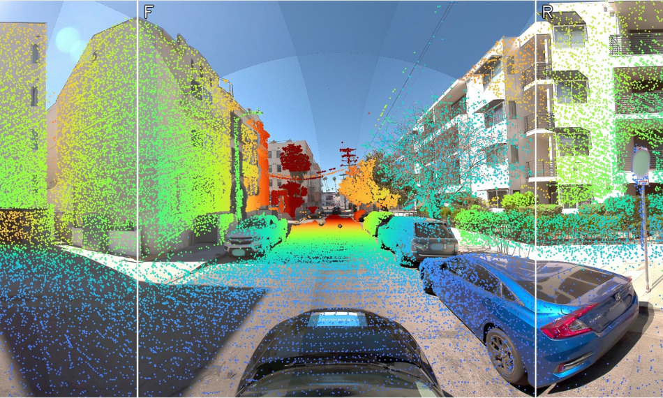
LiDAR data is comprised of densely-packed three-dimensional point clouds, and we optimize the output by simultaneously obtaining LiDAR data and spherical images during the capture process. This allows the spherical images to be used on their own for visual reference or to colourise the LiDAR data.

We can supply LiDAR data in multiple formats, including  .e57, .las, .laz, .rcp, .rcs.

LiDAR data

Technical information

The range of a LIDAR sensor refers to the maximum distance at which it can accurately detect objects. For mobile mapping, a range of several hundred meters is typically needed.

The FOV of a LIDAR sensor refers to the angular range over which it can detect objects. For mobile mapping, a large FOV is usually desirable to capture a wide swath of the environment in a single scan.

The point density of a LIDAR sensor refers to the number of individual data points (or "points clouds") that it can generate per unit area. Higher point densities result in more detailed and accurate maps, but also require more processing power and storage capacity.

The scan rate of a LIDAR sensor refers to how quickly it can capture and process data points. For mobile mapping, a high scan rate is needed to create detailed maps of large areas in a reasonable amount of time.

The wavelength of the laser used in a LIDAR sensor affects its ability to penetrate different materials and detect objects of different colors and reflectivity. Shorter wavelengths are better at detecting objects with low reflectivity, while longer wavelengths can penetrate foliage and other obstructions more easily.

The accuracy of a LIDAR sensor refers to its ability to measure distances and positions with a high degree of precision. For mobile mapping, high accuracy is crucial to ensure that the resulting maps are reliable and can be used for a variety of applications.